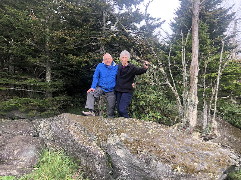
More than a century ago, many of the boulders on Grandfather Mountain were given names, like Sphinx Rock and Split Rock. Now you, too, can bestow a boulder with a name that will be remembered for all time. The Grandfather Mountain Stewardship Foundation presents an exclusive, elite giving program, the Grandfather Mountain Boulder Club. Set your legacy in stone!
Individuals or companies whose total donations reach or exceed a level of $5,000 will be eligible for membership, wherein they can help assign a permanent name to one or more of Grandfather Mountain’s iconic boulders or other natural features. All named boulders will be photographed, described, located by GPS coordinates and featured in a prominent display located in the Wilson Center.
Each “adopted” boulder is featured below. A lasting benefit of naming a feature on Grandfather Mountain is the knowledge that the boulder will remain unaltered in perpetuity, in a place where your grandchildren and your grandchildren’s grandchildren can pause and ponder. See other ways to support our Foundation.
Grandfather Mountain thanks our Boulder Club members for their generous gifts. If you are interested in naming a boulder, please contact margaret@grandfather.com.
Boulder Club Members
Cook's Crag
Barry and Dottie Cook in honor of The Cook Family
Location: Linville Peak
Coordinates: 36.090427, -81.839072
Elevation: 4432'
Dimensions: 81' x 75'
Description: Very large boulder located just slightly southwest of Linville Bluffs.
Heaven on Earth
Bob and Betsy Gefaell in memory of Tom and Lindsay Hayes
Location: Swinging Bridge Parking Area
Coordinates: 36.090427, -81.839072
Elevation: 5,223'
Dimensions: 41' x 15.4' x 3'
Description: This boulder is located at the west end of the bridge parking lot at the base of Morton Peak. It is downslope from the Ruggiero Boulder. This area habitats many rare and endangered species, such as Allegheny Sand Myrtle.
Dr. Mom's Boulder
Bob and Susan Wilson in memory of Marguerite Barrier Cooper
Location: Cliffside Overlook
Coordinates: 36.0929806, -81.8361111
Elevation: 4885'
Dimensions: 23' x 31'
Description: This boulder is the highest rock at Cliffside Overlook, the original terminus of the road. From here, past visitors would hike up to the higher peaks of Grandfather Mountain. From the top of this boulder, you can enjoy nearly 360 degree views of the surrounding region.
Tuppy's Boulder
Bob and Susan Wilson in memory of Tuppy Weatherman Barrier
Location: Cliffside Overlook
Coordinates: 36.0929472, -81.8360611
Elevation: 4883'
Dimensions: 23' x 18'
Description: This boulder is one of the largest boulders at Cliffside Overlook, the original terminus of the park road. This area is a great place have a picnic. Views to the east look to Grandmother Mountain and the peaks on the rim of the Linville Gorge, the closest congressionally designated wilderness area to Grandfather Mountain.
The Barrier Boulder
Bob and Susan Wilson in memory of Lloyd Grady Barrier
Location: Cliffside Overlook
Coordinates: 36.0929194, -81.8361528
Elevation: 4879'
Dimensions: 33' x 14'
Description: This boulder is nestled in the vegetation at Cliffside Overlook. It has an interesting diversity of plants beside it. Huckleberries, Blue Ridge Goldenrod and Silverling are found alongside this boulder.
Cosby/Rinehart Boulder
Bruce and Mary Rinehart in memory of Mr. and Mrs. Halcourt T. Cosby
Location: Cliffside Overlook
Coordinates: 36.0927300, -81.8361990
Elevation: 4853'
Dimensions: 20' x 6'
Description: Low cluster of boulders located under the nice Red Spruce (the Burton Tree) on the right side of the parking lot at Cliffside.
Soaring Eagle
Bud and Helen Fisher, June, Jesse, Jordan and Jonathan Ray in memory of Jeremy Dale Fisher
Location: Black Rock Trailhead
Coordinates: 36.095556, -81.828611
Elevation: 5,030'
Dimensions: 12'x5'x4'
Description: Located a few steps onto the Black Rock Trail off to the right, this boulder serves as a good landmark for the trailhead. Covered in lichen with a Catawba rhododendron growing through a crack, this boulder has both a good view of the trail and the vista looking west toward Lenior.
Cousins’ Clubhouse
Catherine Morton
Location: Mile-High Swinging Bridge
Coordinates: 36° 5'42.97", -81° 49'56.67"
Elevation: 5264’
Dimensions: 25’ x 20’
Description: A large boulder located near the Mile-High Swinging Bridge near the top of the Bridge Trail. This boulder has a unique overhang that made it the perfect location for Catherine Morton, her siblings, and cousins to make into a clubhouse in their youth. They loved spending time there, out of sight, where they could hear all the conversations on the Bridge and listen to the birds and wind.
Herman's Hideaway
Danny, Chris and Jackie Herman in memory of Justin Herman
Location: Extension Trail
Coordinates: 36.095898, -81.827094
Dimensions: 11’ x 5.5’ x 2.5’
Description: A metasandstone rock that is mostly covered in several species of lichens and mosses. It is located in the spruce-fir forest along the Extension Trail. It is surrounded by many wildflowers in the spring and summer, as well as rosebay rhododendron. Due to the habitat, it is a favorite location for neotropical migrant warblers and many other birds in the spring and summer.
Linville View at Cliffside
David and Cathy Thompson
Location: Cliffside Overlook
Coordinates: 36.0925850, -81.836287
Elevation: 4867'
Dimensions: 69.9' x 37' x 10'
Description: Very large boulder at Cliffside Overlook. Located on the left side, looking out onto Linville. This was the original location of the Top Shop.
Grandfather Mountain Staff Boulder
Donated by Staff of the Grandfather Mountain Stewardship Foundation
Location: Conservation Campus
Coordinates: 36.09, -81.835556
Elevation: 4,510’
Dimensions: 4’ x 4’ x 2.5’
Description: This is the feature boulder located outside of the Wilson Center for Nature Discovery. It sits directly beneath the sign for the building and is along the main entrance pathway to the Wilson Center. GMSF staff collectively contributed funds to support the Fulfilling Promise Campaign to complete the Conservation Campus, including the Wilson Center.
Wohali (Eagle)
Dottie & Breanna Warlick in honor of John Warlick
Location: Near the lower entrance of the Bridge Trail
Coordinates: 36.095, -81.830
Elevation: 5,015’
Dimensions: 8’ x 3.5’ x 2’
Description: A cluster of five metasandstone boulders. These boulders overlook the vast view of the Blue Ridge Mountains from the beginning of the Bridge Trail. During the summer, lots of yarrow and ox-eyed daisies surround these boulders. Several different species of lichen call these boulders home.
This also includes the 12-foot tall red spruce tree behind the boulders. This tree is located at the beginning of the ecological zone known as Spruce-fir Forest. The cones that this tree produces attracts many different species of birds, notably the Red crossbill whose “cross” bill is highly adapted to open the spruce cones to eat the seeds inside.
“Going to the mountains, is going home.” ~ John Muir
Wood Boulder on Wood's Way
Dr. and Mrs. James Wood
Location: Woods Walk
Coordinates: 36.087392, -81.841663
Elevation: 4430’
Dimensions: 45’7” x 23’4” x 6’6”
Description: This is a prominent rock feature in the Woods Walk Picnic Area. The metasandstone rock is nestled in the Northern Hardwood Forest, and the sides are covered with mosses and lichens, with ferns growing in the cracks. The top of the rock has less of this vegetation due to people enjoying climbing and sitting atop this rock for many years while their families have picnics.
Sandy Jones Memorial Boulder
Grandfather Mountain Highland Games
Location: MacRae Meadows
Coordinates: 36.085521, -81.849800
Elevation: 4301’
Dimensions: 40 feet x 35 feet x 5.5 feet
Description: A cluster of four meta-sandstone rocks. Partially covered in different species of mosses, lichens and ferns. Shaded by mountain laurel, maple, yellow birch and green ash trees. Sandy Jones was recruited by Grandfather Mountain Highland Games Founder Agnes Morton to bring piping to the fore at the Games. Over his decades with the organization, he served as Director of Piping, a board member, the 10th president of the Games, a trustee and a consistent ambassador.
Bubba's Rock
Jerry and Janet Enos
Location: Forrest Gump Picnic Area
Coordinates: 36.091619, -81.834831
Elevation: 4,864'
Dimensions: 27.6' x 46.3' x 12.8'
Description: Bubba's Rock, a large boulder hidden off the back of the Forrest Gump Overlook, is adopted in gratitude for the reminder of nature's awe-inspiring endurance.
Goodmon Family Boulder
Jim and Barbara Goodmon in honor of The Goodmon Family
Location: Elk Habitat
Coordinates: 36.089167, -81.835833
Elevation: 4625'
Dimensions: 35' x 41'
Description: Very large boulder in the Elk Habitat located near the Elk Barn.
The Magruder Boulder
Jim and Frances Magruder
Location: Mile-High Swinging Bridge
Coordinates: 36.095833, -81.8325
Elevation: 5,240’
Dimensions: 12’ x 6’ x 3’
Description: This boulder sits off the west side of the swinging bridge parking area, overlooking the valley leading to MacRae Meadows and Grandfather Golf and Country Club. There is a base boulder with 5 smaller rocks stacked off the backside. It is surrounded by blue ridge goldenrod, one of Grandfather Mountain's many endangered species. A lone spruce tree provides shade.
Melinda's Magic Merryland
Jim Morton in honor of Melinda Romans Bartlett
Location: Cliffside Overlook
Coordinates: 36.0928361, -81.8364694
Elevation: 4887'
Dimensions: 31' x 20'
Description: This unique cluster of boulders, with multiple cracks and fractures is a favorite of visitors. It lies just beneath Linville Peak and provides an incredible vantage point to peaks in the High Country, including Mount Mitchell.
Bailey's Holie Boulder
Jim Morton in honor of Bailey Bartlett
Location: Cliffside Overlook
Coordinates: 36.0929694, -81.8359556
Elevation: 4883'
Dimensions: 11' x 8'
Description: This petite boulder has a unique feature. This hole likely started as a weathering pit; these pits are formed from the erosive power of wind and water swirling sediments around an area to form a circular indention in the rock.
Take a Load Off Annie
Jim Morton in honor of Annie McGowan
Location: Bridge Trail
Coordinates: 36.0953500, -81.8321944
Elevation: 5260'
Dimensions: 8' x 13'
Description: This large round boulder is located near the top of the Bridge Trail below the Swinging Bridge. It serves as a great resting stop and reflection point for park visitors. The Mile High Swinging Bridge was originally placed across the gorge below in 1952.
Be Still and Know
Jim Morton in honor of Kelly McGowan
Location: Bridge Trail
Coordinates: 36.0953194, -81.8321917
Elevation: 5262'
Dimensions: 14' x 16'
Description: This boulder is located near the top of the Bridge Trail under the Mile High Swinging Bridge. American Mountain Ash, a common tree of the high elevations of Grandfather Mountain, is found nearby this boulder. The tree produces an abundance of red berries for wildlife in the fall.
Breath of Fresh Air
Jim Morton in honor of Diane Volkers
Location: Linville Peak
Coordinates: 36.0944583, -81.8329528
Elevation: 5298'
Dimensions: 17' x 6'
Description: This elongated boulder near the summit of Linville Peak is a great vantage point to areas on the eastern side of Grandfather Mountain. Points of interest here include the Blue Ridge Parkway, the Pisgah National Forest and on the clearest days, the skyline of Charlotte, NC.
The Holbrook Field Trips Boulder
John and Susan Holbrook in memory of John A. Holbrook III, founder
Location: Animal Habitat Trailhead
Coordinates: 36.0901194, -81.8352028
Elevation: 4701'
Dimensions: 31' x 24'
Description: This boulder is the gateway boulder to the Mildred the Bear Environmental Habitats. School groups often visit the animal habitats to learn about the park’s native wildlife.
Flight of Dreams: July 13, 1974
John Harris
Location: Cliffside Overlook
Coordinates: 36.0928361, -81.8364694
Elevation: 4911'
Dimensions: 37' x 38'
Description: On July 13, 1974, John Harris became the first man to fly a hang glider off Grandfather Mountain. The 1500-foot flight was described in The State magazine this way: For a few glorious moments, Harris soared free of the earth, sailing effortlessly over the valley, with nothing but the mountain winds and a single wing to keep him aloft.
Barrett Rock
Jon & Lisa Barrett
Location: Morton Peak
Coordinates: 36.0958500, -81.8330222
Elevation: 5231'
Dimensions: 54' x 21'
Description: This large block-shaped boulder, presumably was once connected to Morton Peak. It is currently resting on the western slope and prominently visible from the Mile High Swinging Bridge.
Morton Peak
Julia Morton in honor of The Morton Family
Location: Morton Peak
Coordinates: 36.0963917, -81.8322111
Elevation: 5326'
Dimensions: 524' x 367'
Description: Morton Peak was formerly known as Second Peak is located north of Linville Peak. It is roughly twenty feet higher than Linville Peak. It is named in honor of the Morton family, the founders of the park. This family has worked tirelessly to create the nature park and preserve the unique plants and animals found on the mountain.
The Grave Yard Boulder
Kelly and Meredith Graves in honor of Kelly Graves' Family
Location: The Bear Habitats
Coordinates: 36.0896611, -81.8340944
Elevation: 4585'
Dimensions: 24' x 12'
Description: This boulder, located in the lower bear habitat, was once a popular location for Mr. Morton, who photographed bears with park visitors. As a park policy, we no longer enter the bear habitats.
Powell's Perch
Linda Powell in memory of William Powell
Location: Black Rock Trailhead
Coordinates: 36.095556, -81.82833
Elevation: 5020'
Dimensions: 6'x10'x4'
Description: This large flat-topped boulder sits just to the right off of Black Rock Trailhead tucked in amongst the rhododendron. There are ferns and moss growing on top.
The Lockwood Family Rocks!
Lory Lockwood and Andrew Watts, Ray Lockwood in honor of The Lockwood Family
Location: Cliffside Overlook
Coordinates: 36.0927998, -81.8359093
Elevation: 4330'
Dimensions: 30' x 10'
Description: Collection of 4 boulders at Cliffside Overlook. Located on the right of the parking lot, directly behind and up the hill from waste container, on the right, prior to the picnic table.
Next Level
Margaret McKibbin and Paul Kroening
Location: Cliffside Overlook
Coordinates: 36.0927778, -81.836111
Elevation: 4900'
Dimensions: 4' x 6'
Description: This boulder is nestled between a mountain ash and wild blueberry and has veins of quartz running throughout. It is located on the uphill side, north of the Cliffside Overlook parking area. It has expansive views, looking out over Grandfather Golf and Country Club's Loch Dornie in one direction and Pisgah National Forest in the other.
Wildcat Rock
Patricia Wykstra Johnson in honor of University of Kentucky Wildcats and cougars Logan and Trinity, in memory of Aspen the cougar
Location: Cougar Habitat (close to the viewing overlook)
Coordinates: 36.089167, -81.835278
Elevation: 4,660'
Dimensions: 60' x 20' x 15'
Description: This large boulder is nestled beneath the favorite tree of Aspen, one of Grandfather's former resident cougars. Logan and Trinity, our two current cougars, enjoy this rock while greeting guests during their enrichments. It is surrounded by various lichen, rock tripe, a mountain ash tree and other native flora.
The Hill Family Boulder
Richard and Mary Hill
Location: Woods Walk
Coordinates: 36.087347, -81.841580
Dimensions: 33’ x 28’ x 10’
Description: A metasandstone rock that is partially covered in lichens, mosses, and ferns that are growing in the crevices. It is located in the Woods Walk Picnic Area within a Northern Hardwood Forest shaded by red maples, northern red oaks, and American beech trees.
Lilly-Ann Darlington Lookout
Sebastian Ruggiero in memory of Lillian Darlington Singletary
Location: Swinging Bridge Parking Area
Coordinates: 36.0960306, -81.8326528
Elevation: 5,252'
Dimensions: 27' x 21'
Description: This massive boulder is located just off of the Mile High Swinging Bridge parking area. High elevation rocky outcroppings provide habitat for rare and endangered plants and animals, including Blue Ridge Goldenrod.
Ruggiero's Lookout
Sebastian Ruggiero in honor of the Sebastian Ruggiero family
Location: Swinging Bridge Parking Area
Coordinates: 36.0959833, -81.8326056
Elevation: 5241'
Dimensions: 17' x 6'
Description: This rectangular boulder is located on the west end of the Mile High Swinging Bridge parking lot. Some of the highest winds in the state funnel through this parking lot, especially in the winter.
Writer's Block
Tica Walley in honor of Sunday Morning with Charles Kuralt
Location: Anvil Rock Cottage
Coordinates: 36.0881111, -81.8475750
Elevation: 4357'
Dimensions: 10' x 6'
Description: Writer’s Block is located at the foot of the famous Anvil Rock cabin. The cabin was a month-long residence for the late author Charles Kuralt. Kuralt used this location to write Charles Kuralt’s America. This historic cabin has been a retreat for special guests to Grandfather Mountain. The western wall of the building is the Anvil Rock boulder.
Be Playful
Tica Walley in memory of Dennis H. Walley
Location: Otter Habitat
Coordinates: 36.0890444, -81.8344722
Elevation: 4686'
Dimensions: 24' x 20'
Description: This boulder is located just above the North American River Otter Habitat. A park amphitheater which hosted bear programs was once situated at the base of this rock. Today it forms a boundary to the River Otter habitat area.
A Peaceful Place
Tucker and Karen Mann in memory of Tucker Rives Mann
Location: Linville Bluffs
Coordinates: 36.090836, -81.838497
Elevation: 4,776'
Dimensions: 18.4' x 14.2' x 4.3'
Description: This Peaceful Place is surrounded by Red Spruce, Eastern Hemlock, Mountain Ash, Yellow Birch and Rosebay Rhododendron.
Bubba Schmenkelstein
Warren and Larissa Bare
Location: Conservation Campus
Coordinates: 36.08981, -81.83548
Elevation: 4,690’
Dimensions: 27” x 21” x 40”
Description: This tall boulder, located where paths cross by the Cobey Botanical Gardens and the Mildred the Bear Wildlife Habitats, greets visitors who come to explore the Conservation Campus. It is surrounded by lush grasses and hairy alumroot, and it has a beautiful view of Linville Peak in the distance. Guests can also trace the turkey prints on the walking paths that hug the boulder.